
Product Information
360° Flight, Reimagined
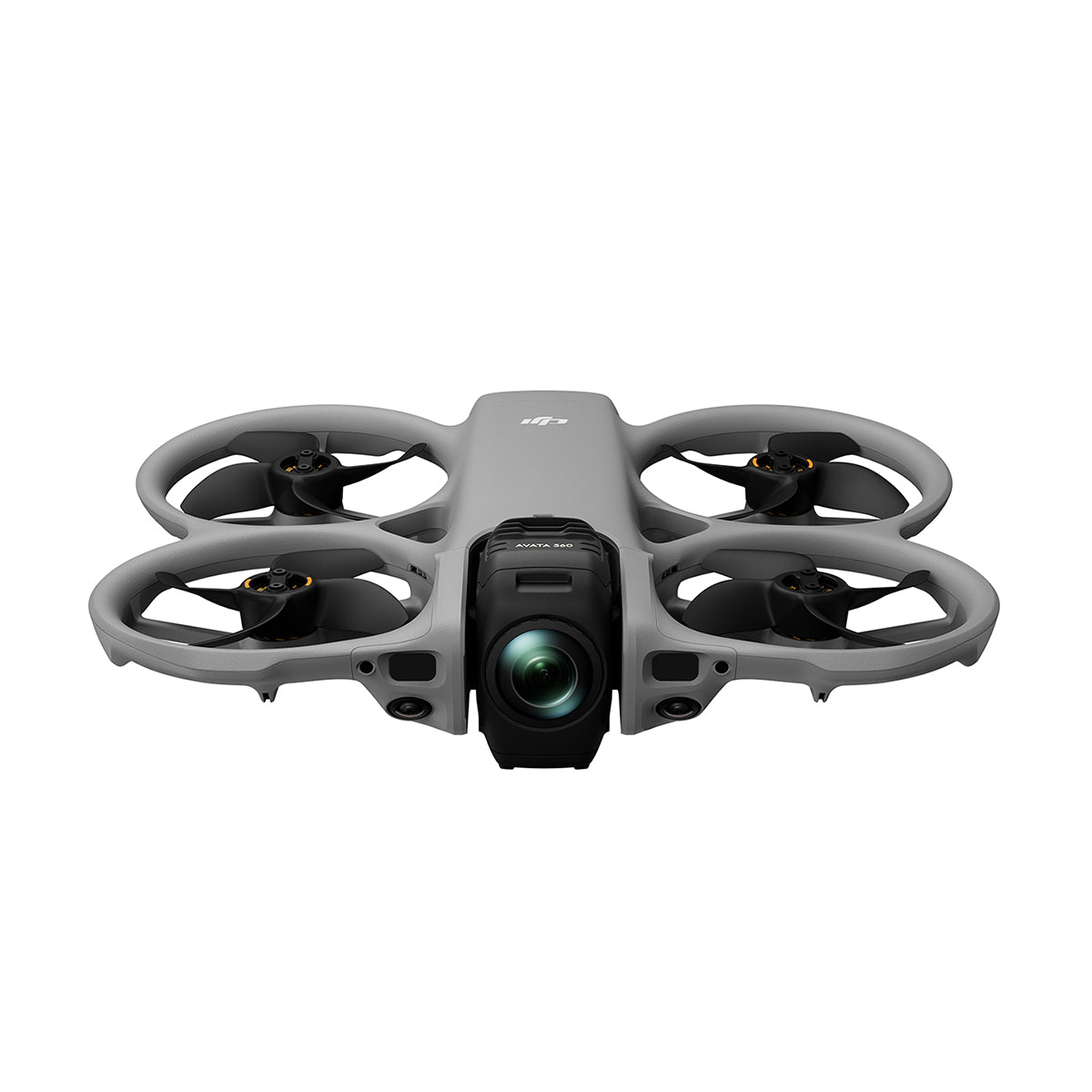
Step into an entirely new way of capturing the world from above with the DJI Avata 360. Designed to blend immersive FPV flight with cutting-edge 360° imaging, this drone gives you the freedom to explore perspectives that were once impossible. Whether you're chasing fast-moving action or drifting through scenic landscapes, every moment is captured in full, giving you the flexibility to shape your story long after the flight is over.

Uncompromising Image Quality
At the heart of the Avata 360 is a powerful imaging system built to deliver stunning detail and dynamic range. With its large sensor design and advanced processing, it captures crisp 8K HDR video and ultra-high-resolution 360° photos that hold up beautifully even when reframed. Highlights and shadows are rendered with depth and clarity, allowing your footage to feel as rich and dimensional as the experience itself.

One Flight, Endless Possibilities
The true magic of 360° capture lies in what happens after you land. With a single take, you can create multiple unique shots—shifting angles, reframing compositions, and even adding dynamic camera movements in post. From sweeping cinematic reveals to fast-paced FPV-style edits, the Avata 360 gives creators the flexibility to experiment without missing a moment in the air.

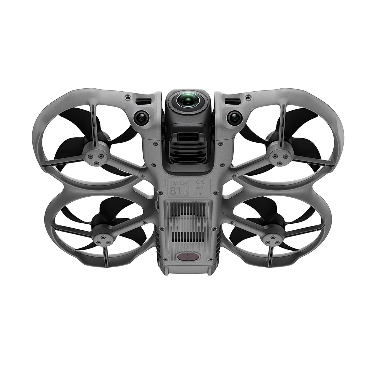
Immersive Control and Transmission
Built for both precision and immersion, the Avata 360 adapts to your preferred flying style. Traditional controls offer smooth, deliberate camera movement, while immersive FPV options let you experience flight as if you’re right there in the cockpit. A robust video transmission system ensures a clear, responsive live feed, helping you stay connected and confident no matter where you fly.
![]()
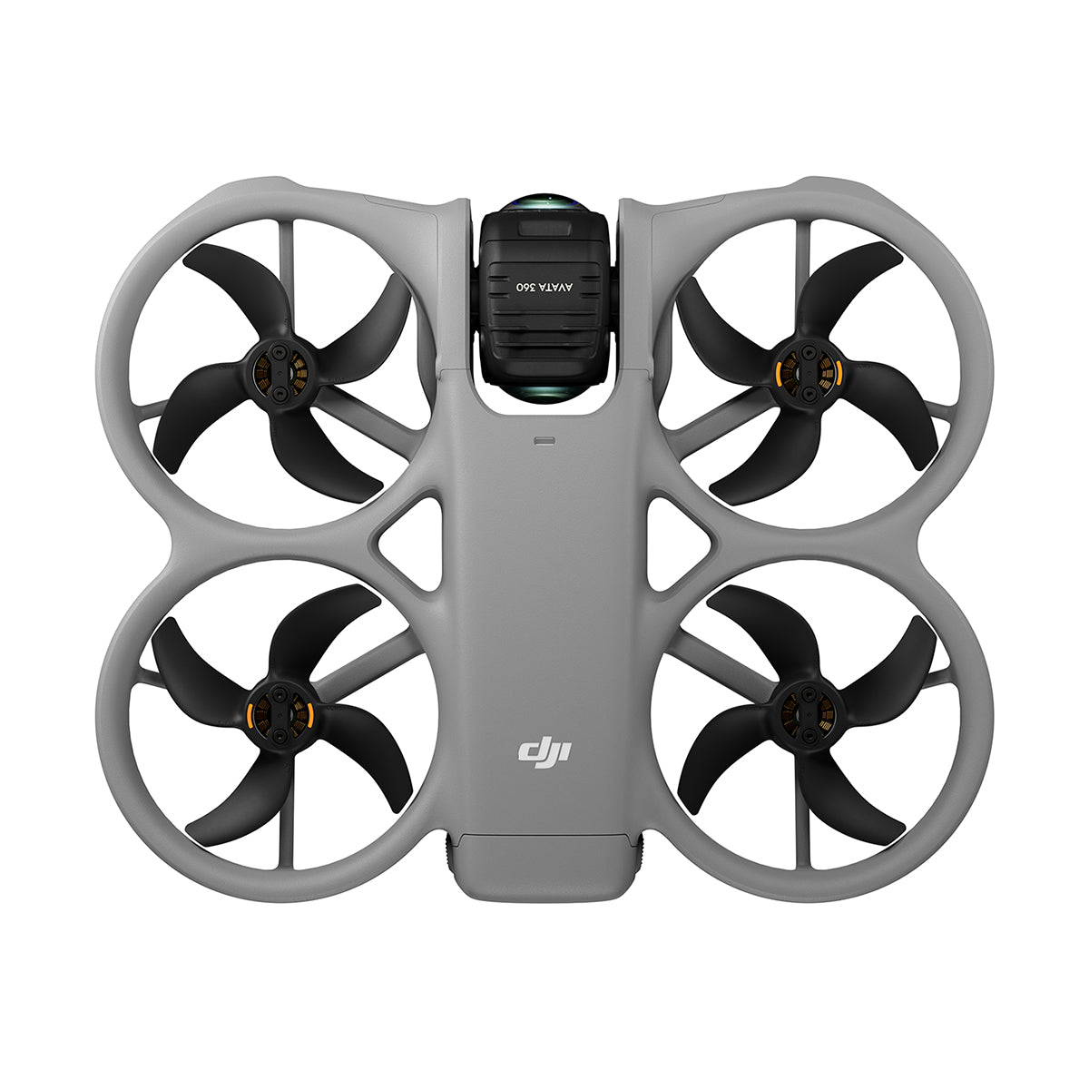
Confident Flying, Creative Freedom
Flying feels intuitive and secure thanks to advanced obstacle sensing and a fully integrated propeller guard. These thoughtful design elements make it easier to navigate complex environments and capture dynamic tracking shots, even if you’re still building your skills. The result is a drone that encourages creativity without adding unnecessary stress.
![]()
Streamlined Workflow, Faster Results
From capture to sharing, the Avata 360 is built to keep your workflow moving. High-speed wireless transfers, built-in storage, and intuitive editing tools allow you to review, refine, and export your footage quickly. Whether you prefer quick social-ready edits or more detailed post-production, the process feels smooth and efficient every step of the way.
-
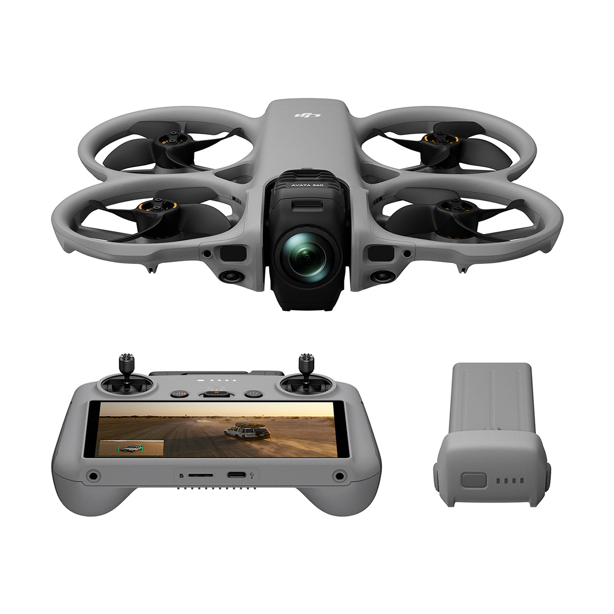
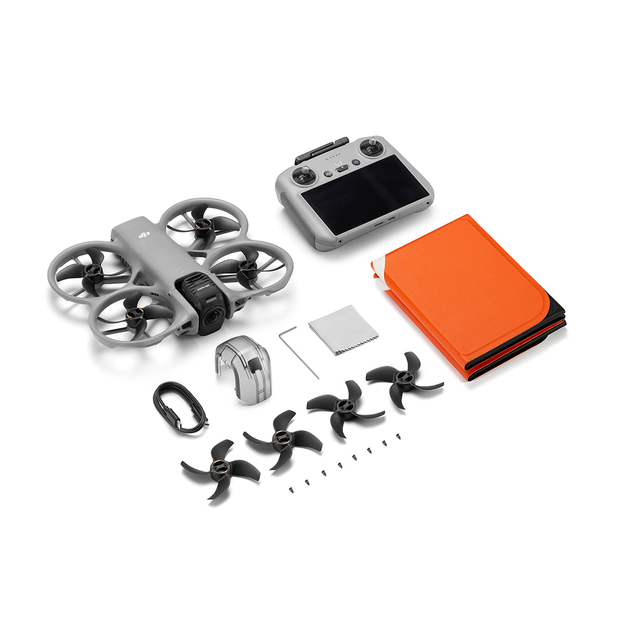
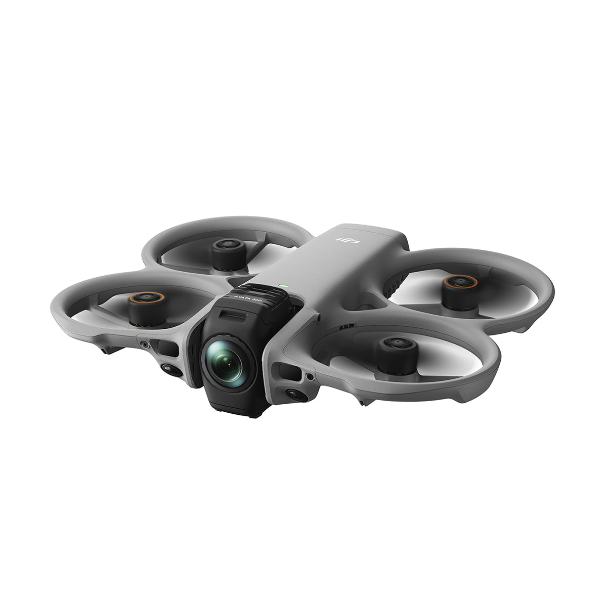
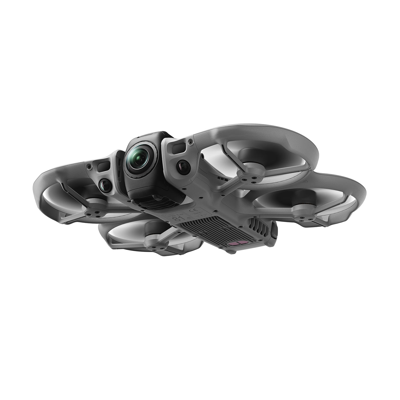
Avata 360 Drone
-
RC 2 Controller
-
1x Avata 360 Intelligent Flight Battery
-
Gimbal Protector
-
2x Spare Propellers (Pair)
-
Foldable Landing Pady
-
USB-C to USB-C Data Cable
| Aircraft | |
|---|---|
| Takeoff Weight | Approx. 455 g |
| Dimensions | 246×199×55.5 mm (L×W×H) |
| Max Ascent Speed | 2 m/s (Cine mode) 6 m/s (Normal mode) 10 m/s (Sport mode) |
| Max Descent Speed | 1.5 m/s (Cine mode) 6 m/s (Normal mode) 10 m/s (Sport mode) |
| Max Horizontal Speed | At sea level, in windless conditions: 6 m/s (Cine mode) 16 m/s (Normal mode) 18 m/s (Sport mode) |
| Max Takeoff Altitude | 4500 m |
| Max Flight Time | Approx. 23 mins |
| Max Hovering Time | Approx. 22 mins |
| Max Flight Distance | 13.5 km |
| Max Wind Speed Resistance | 10.7 m/s (Level 5) |
| Max Pitch Angle | 48° |
| Operating Temperature | -10° to 40° C (14° to 104° F) |
| Global Navigation Satellite System | GPS + Galileo + BeiDou |
| Internal Storage | 42 GB |
| Class | C1 (EU) |
| Camera | |
|---|---|
| Image Sensor | Two 1/1.1-Inch Square CMOS Sensors Effective Pixels per Sensor: 64MP |
| Lens | FOV: 200° Format Equivalent: 7.8 mm Focal Length: 2.5 mm Aperture: f/1.9 Focus Mode: FF Focus: 1.5 m to ∞ |
| ISO Range | 360° Video: 100-25600 (Normal), 100-12800 (D-Log M) 360° Photo: 100-6400 Single-Lens Video: 100-12800 |
| Shutter Speed | Video: 1/8000-1/25 s Photo: 1/8000-1/30 s |
| Still Photography Mode | 360° Mode: 30 MP or 120 MP |
| Max Image Size | 360° Photo: 15520×7760 |
| Photo Format | JPEG/DNG |
| Video Resolution | 360°: Up to 8K (7680×3840) Single Lens: Up to 4K |
| Video Format | OSV/MP4 (H.265) |
| Max Video Bitrate | 180 Mbps |
| Color Mode | Normal, D-Log M |
| Supported File System | exFAT |
| Gimbal | |
|---|---|
| Stabilization | Single-Axis Mechanical Gimbal (tilt) 360° Virtual Gimbal |
| Controllable Range | Tilt: -180° to 180° Roll: -180° to 180° |
| Max Control Speed | Tilt: 100°/s Roll: 100°/s |
| Angular Vibration Range | ±0.01° |
| Sensing | |
|---|---|
| Sensing Type | Omnidirectional vision system with forward LiDAR and infrared sensor |
| Forward | Measurement Range: 0.5-20 m FOV: Horizontal 90°, Vertical 90° |
| Backward | Measurement Range: 0.5-18 m |
| Lateral | Measurement Range: 0.5-18 m |
| Upward | Measurement Range: 0.5-18 m |
| Downward | Measurement Range: 0.5-20 m |
| Operating Environment | Diffuse reflective surfaces with adequate lighting |
| Video Transmission | |
|---|---|
| Video Transmission System | O4+ |
| Live View Quality | Up to 1080p |
| Operating Frequency | 2.4 GHz / 5.1 GHz / 5.8 GHz |
| Communication Bandwidth | Max 40 MHz |
| Max Transmission Distance (Unobstructed) | Up to 20 km (FCC) |
| Lowest Latency | Approx. 130 ms |
| Max Video Bitrate | 60 Mbps |
| Max Download Speed | Up to 100 MB/s (Wi-Fi 6) |
| Antennas | 4 antennas, 2T4R |
| Battery | |
|---|---|
| Capacity | ≥ 2700 mAh |
| Weight | Approx. 149 g |
| Nominal Voltage | 14.32 V |
| Max Charging Voltage | 17.2 V |
| Battery Type | Li-ion |
| Energy | ≥ 38.67 Wh |
| Discharge Rate | 7C (typical) |
| Charging Temperature | 5° to 40° C (41° to 104° F) |
| Charging Time | Approx. 47 min (single battery via hub) |
| Charger | |
|---|---|
| Recommended Charger | DJI 65W Portable Charger / DJI 100W USB-C Power Adapter |
| Battery Charging Hub | |
|---|---|
| Input | 5-20 V, max 5 A |
| Output (Power Accumulation) | Max 60 W |
| Output (Charging) | Max 17.2 V |
| Output (USB) | 30 W |
| Charging Type | Supports up to three batteries simultaneously |
| Compatibility | DJI Avata 360 Intelligent Flight Battery |
| Storage | |
|---|---|
| Single Card Slot | MicroSD (Up to 1TB) |
| Connectivity | |
|---|---|
| Wi-Fi | 802.11 a/b/g/n/ac/ax |
| Wi-Fi Frequency | 2.4 GHz / 5.8 GHz |
| Bluetooth | Bluetooth 5.4 |
| Bluetooth Frequency | 2.4 GHz |